-
Shop our Range
▼
- Deals & Promotions ►
-
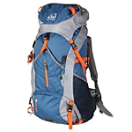
Fishing
►
Featured Fishing Categories
-
Boating
►
Featured Boating Categories
-
Marine Electronics
►
Featured Marine Electronics Categories
-
Diving & Snorkeling
►
Featured Diving & Snorkeling Categories
-
Watersports
►
Featured Watersports Categories
-
Apparel
►
Featured Apparel Categories
-
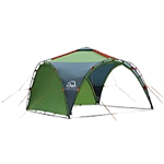
Camping & Hiking
►
Featured Camping & Hiking Categories
-
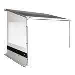
RV & Motorhomes
►
Featured RV & Motorhomes Categories
-
Hunting
►
Featured Hunting Categories
-
Shop By Brand
►
-
How Can We Help You?
Give Us A Call 0800 633 257
Or get us to call you...
Note: Our shop is open Monday to Friday 8:00am to 6:00pm, Saturday 8:00am to 5:00pm and Sunday 10:00am to 4:00pm (closed public holidays).
- Fast Shipping with CourierPost 95% orders shipped same day*
- Full Warranty We'll refund, repair or replace your item*
- No Worries Returns Submit a request, receive our return label & ship it back
- Lowest Price Guarantee Find a lower price, we'll match it or we can do better!
- Massive Range 21,000+ products in stock ready to ship!


The item you're looking at is currently unavailable or has limited stock, how about this one instead?

- Details
-
Details

Now with SonarChart!
Whether you're on the water or planning a trip, Navionics Plus charts can take you there! The Navionics Plus Chart Card is a 2-dimensional marine chart that's considered to be the navigation standard for serious mariners and fishermen. Now with SonarChart, this chart lets you see extraordinary bottom contour detail, great for increasing awareness of shallow waters and for locating fishing areas at any depth level. You can also switch to the standard Nautical chart appearance by simply pressing 1 button. The Navionics Plus provides superior detail, shaded depth contours, real-world shapes, colours for buoys and navaids, tide and current data, spot soundings and many more. It's your ultimate companion and navigator across the seas.
Just plug and play into a Navionics compatible plotter and have easy access to all the essential information found on official paper charts and fishing maps. These Navionics charts provide navigators and fishermen all the necessary data for safer and easier navigation.
SonarChart
SonarChart is an HD bathymetry map featuring extraordinary bottom contour detail, great for increasing awareness of shallow waters and for locating fishing areas at any depth level.
1 ft/0.5 m HD bathymetry
Enjoy the exclusive SonarChart layer with up to 1 ft/0.5 m contours. Upload your sonar logs to build even better local charts for your area. You can do it with your plotter or use your mobile device connected wirelessly to your sounder with SonarChart Live.
Worldwide Regions
Navionics+ is a versatile and innovative product. Preloaded regions are ready to use, while the downloadable Global Regions version lets you choose your coverage area during activation. Both allow you to download and update the marine and lakes content and chart layers you want with great flexibility.
Navionics Plus Chart Card Features:
- Nautical Chart, SonarChart and Community Edits in one
card
- High definition layer
- Take advantage of daily updates
- Format: CF Card
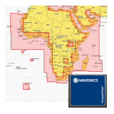
- Coverage: Africa and Middle East
Compatible Models For: Navionics Plus CF Chart Card:
- Raymarine: G-Series G120, G150, G170, G190,
GPM400; E-Series Widescreen E140W, E120W, E90W; C-Series Widescreen
C140W, C120W, C90W; A-Series 70, 70D, 57, 57D, 50, 50D
- geonav: 11 C Net; 11 C; 7 Wide, Wide Net; 5
Touring; 4 Gipsy, Gipsy NMEA; Multy; 11 Flash, Sun, Sunshine; 10 C;
8 Sunshine; 7 C; 6 Sun, Sunshine; 5 C; 4 CXS, C
- Northstar: 6100i (requires S/W update 7.76);
6000i
What happens if your Model of GPS is not on the list above? Most likely this is the wrong chart for your machine! So try looking through our range of other GPS Charts to find the correct card for your unit. Or you can also check the Navionics website for the latest Compatibility Guides - Nautical Chart, SonarChart and Community Edits in one
card
Products You Recently Viewed
-
Navionics Plus 30XG Africa and Middle East CF Chart Card
 Why pay $409.00ONLY $299.00SAVE $110.00!
Out of stock