-
Shop our Range
▼
- Deals & Promotions ►
-
Fishing
►
Featured Fishing Categories
-
Boating
►
Featured Boating Categories
-
Marine Electronics
►
Featured Marine Electronics Categories
-
Diving & Snorkeling
►
Featured Diving & Snorkeling Categories
-
Watersports
►
Featured Watersports Categories
-
Apparel
►
Featured Apparel Categories
-
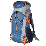
Camping & Hiking
►
Featured Camping & Hiking Categories
-
RV & Motorhomes
►
Featured RV & Motorhomes Categories
-
Hunting
►
Featured Hunting Categories
-
Shop By Brand
►
-
How Can We Help You?
Give Us A Call 0800 633 257
Or get us to call you...
Note: Our shop is open Monday to Friday 8:00am to 6:00pm, Saturday 8:00am to 5:00pm and Sunday 10:00am to 4:00pm (closed public holidays).
- Fast Shipping with CourierPost 95% orders shipped same day*
- Full Warranty We'll refund, repair or replace your item*
- No Worries Returns Submit a request, receive our return label & ship it back
- Lowest Price Guarantee Find a lower price, we'll match it or we can do better!
- Massive Range 21,000+ products in stock ready to ship!


The item you're looking at is currently unavailable or has limited stock, how about this one instead?

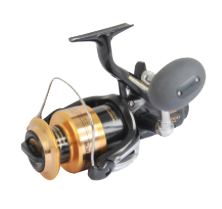
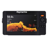
Humminbird HELIX 12 CHIRP Mega SI+ G4N GPS/Fishfinder
Why pay
$5,269.00
ONLY
$3,499.00
SAVE
$1,770.00!
- Details
-
Details

Fish smarter - above and below the waterline
Knowledge is power—and the new Raymarine Element 7 HyperVision CHIRP GPS/Fishfinder gives you the upper hand when hunting for fish and their habitat. Delivering the sharpest view of the underwater world, Element's HyperVision 1.2 megahertz sonar technology, turns up the resolution of DownVision, SideVision, and RealVision 3D to a new level of precision imaging and fish identification, letting you see structures, vegetation, and fish with amazing life-like clarity.
Package Includes:
- Raymarine Element 7 HyperVision CHIRP GPS/Fishfinder
- Navionics Plus NZ/AU Chart Card
- HV-100 Transducer with 6m cable
- Installation hardware
Bright and Rugged
Sunlight viewable displays with integrated GPS/GNSS receiver.
Superior HyperVision
1.2 megahertz CHIRP sonar technology delivers much higher resolution imaging compared to conventional side and down scanning sonars.
RealVision 3D Built-In
Accurately identify the location of ledges, channel beds, and other contour changes.
Fast Quad-Core Processor
For instantaneous chart re-draw and sharp 3D imaging.
Simple LightHouse Sport Operating System
Optimised for fishing, the LightHouse Sport OS is fast and easy-to-learn.
All-in-one HV-100 HyperVision Transducer
HyperVision uses super high frequencies (1.2 megahertz) and CHIRP technology to bring a new level of precision imaging to DownVision, SideVision and RealVision 3D. The all-in-one design of the Element's HyperVision CHIRP transducer makes it compact and easy to install.
Turn Up the Resolution with HyperVision
- HyperVision uses super high frequencies (1.2 megahertz) and
CHIRP technology to bring a new level of precision imaging to
DownVision, SideVision and RealVision 3D
- 1.2 megahertz HyperVision mode is optimised for super
high-resolution imagery up to 100' (30 metres)
- Switch to standard 350 kHz CHIRP sonar for longer range,
high-resolution imaging, and ranges up to 600' (180
metres)
- Element's advanced CHIRP sonar also operates in the
high-frequency 200kHz range for fish targeting, high-speed bottom
tracking, and depths up to 900ft
Raymarine Element 7 HyperVision CHIRP GPS/Fishfinder Features:
- Sunlight viewable display with integrated GPS/GNSS
receiver
- 1.2 megahertz CHIRP sonar technology
- RealVision 3D Built-In
- Fast Quad-Core Processor
- Precision GPS mapping
Raymarine Element 7 HyperVision CHIRP GPS/Fishfinder Specifications:
General
- Display Size: 7.0" Optically Bonded LCD
- Display Resolution: 800 x 480 WVGA
- Display Type: Non-Touch
- Brightness: 1,500 nits
- Viewing Angle: Top 50° / Bottom 60° / Left 70° / Right
70°
Physical
- Overall Dimensions: 240 x 135 62mm (9.5 x 5.3 x 2.4
inches)
- Product Weight: 3.0lbs
- Water Ingress Protection: IPX6 and IPX7
- Operating Temperature Range: -25°C to + 55°C (-13°F to
131°F)
- Storage Temperature Range: -30°C to +70°C (-22°F to
158°F)
Power
- Voltage: 12V DC (8V to 16V DC)
- Power Consumption (max 12V DC): 15 Watts
Sensors
- GNSS / GPS: Built-in GNSS Receiver: GPS/GLONASS
- Sonar Type (Built-in): Built-in CHIRP Sonar, DownVision
(Standard and Hyper), SideVision (Standard and Hyper), RealVision
3D (Standard and Hyper)
- Sonar Connection: 15 pin HyperVision type connector
- Sonar Depth:
CHIRP Sonar = 274m (900 feet)
DownVision Standard = 183m (600 feet) | DownVision Hyper = 30m (100 feet)
SideVision Standard = 91m (300 feet) | SideVision Hyper = 30m (100 feet)
RealVision 3D Standard = 91m (300 feet) | RealVision 3D Hyper = 30m (100 feet)
Networking
- Ethernet: N/A
- NMEA0183: N/A
- NMEA2000: 1 x NMEA2000 port (DeviceNet microC)
- Supported NMEA2000 Networking: INPUT: NMEA2000 Compatible
Engines (Max 2) | NMEA2000 Compatible Tank Sensors (Max 4) |
Heading Sensor (for Chart Stabilisation)
OUTPUT: GPS (for VHF Distress and DSC) - SeaTalkng: Requires A06045 DeviceNet female (F) adapter cable -
400mm
- USB: N/A
- Wi-Fi: WiFi - 802.11 b / g / n
- BlueTooth: Bluetooth 4.0 + Low Energy + Power Class
1.5
Other
- Cartography: Raymarine LightHouse NC2, Navionics, C-MAP
Essentials, C-MAP 4D MAX+, and compatible with all charts listed on
Raymarine Chart Store.
- Tides & Currents: Requires LightHouse LNC2, Navionics or
C-MAP
- Waypoint / Routes / Tracks: 10,000 wpts / 200 wpt groups / 150
rts - 250 wpt max / 16 tracks - 10,000 max trk pts
- Internal Memory: 8GB Solid State
- External Memory: 1 x microSD slots - microSDHC max 32GB NTFS or
FAT32 format / microSDXC max 2TB NTFS or FAT32 format (microSD
native format of exFAT must be reformatted to NTFS or
FAT32)
What's in the box:
- Element 7 HyperVision GPS/Fishfinder Unit
- Navionics Plus NZ/AU Chart Card
- Trunnion bracket with mounting hardware
- Surface mount kit with mounting hardware
- Sun cover
- Power / NMEA2000 1.5m cable
- Documentation pack
- Cartography (optional)
- HV-100 Transducer with 6m cable
- Transom bracket with mounting hardware
- P-clips with mounting hardware (x5)
- Escutcheon plate with mounting hardware
- Raymarine Element 7 HyperVision CHIRP GPS/Fishfinder
Products You Recently Viewed
-
Raymarine Element 7HV CHIRP GPS/Fishfinder HV-100 Trailer Boat Package
 Why pay $1,799.00ONLY $1,499.00SAVE $300.00!
Out of stock